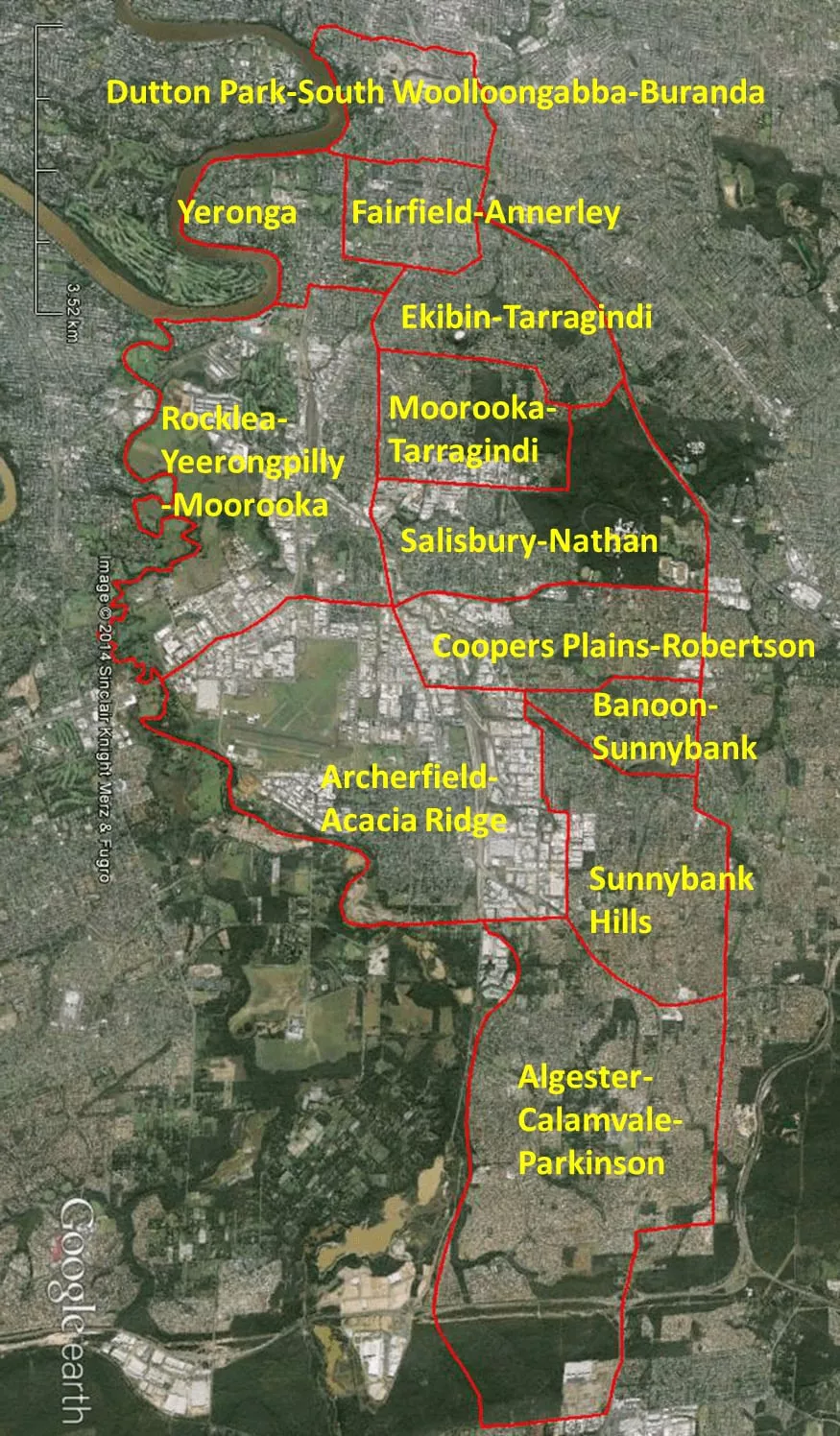
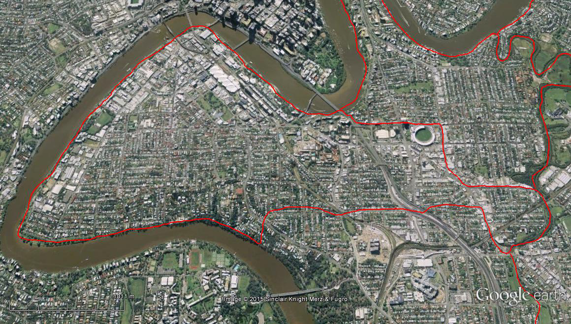
The Spatial Description of the West End-South Brisbane-North Woolloongabba Local Area Study
1 mile = 1.609 km
Accumulative Path:
For Southern West-East boundary, adjoin with Northern West-East boundary of the Fairfield- Annerley Study Area for the 1.08 miles (1.73 km) Home & Victoria Street Intersection to, via Denham Street & Louis Street, Victoria Terrace, line across to Norman Creek.
0.60 miles (0.96 km) on Western South-North boundary, Norman Creek pathway to Logan Road-O’Keefe Street, and 0.33 miles (0.54 km) Logan Road to intersection with Mossgrove Street.
1.30 miles (2.09 km) on Northern East -West boundary, Mossgrove Street to Ipswich Road, line to Morrissey Street, Park Road, Park Road West, to Gladstone Road intersection.
0.93 miles (1.50 km) on Western North- South boundary, line from Park Road West- Gladstone Road intersection to Brisbane River, north & east bank of Brisbane River to point at the end of the parkland near intersection of Brisbane Corso, Newcastle, and Victoria Streets, to the Home & Victoria Street Intersection.
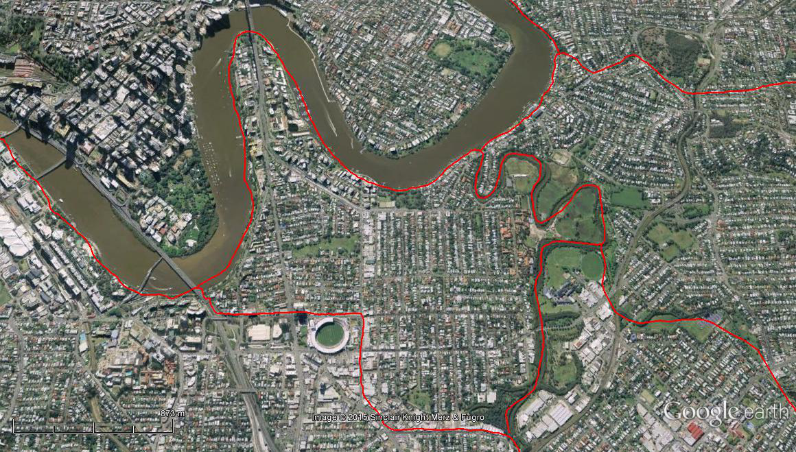
The Spatial Description of the Kangaroo Point-East Brisbane Local Area Study
1 mile = 1.609 km
Accumulative Path:
For Northern East –West boundary, adjoin with part of the Southern East-West boundary of the Fairfield- Annerley Study Area for the 0.53 miles (0.86 km) Villa Street from Ipswich Road Intersection, to Park Road Intersection.
For Eastern South-North boundary, adjoin with Western South-North boundary of the Fairfield- Annerley Study Area for the 3.90 miles (6.27 km) Villa Street & Park Road Intersection to Crutchley & Victoria Street Intersection.
2.65 miles (4.27 km) on Northern and Western boundary from point on Brisbane River at the end of the parkland near intersection of Brisbane Corso, Newcastle, and Victoria Streets, along north & east bank of Brisbane River, to King Arthur Terrace.
1.04 miles (1.68 km) on Southern West- East boundary, King Arthur Terrace to Fairfield Road, line from Fairfield to and along School Road to Ipswich Road intersection.
0.28 miles (0.46 km) for second Eastern South-North boundary, School Road and Ipswich Road intersection to Villa Street and Ipswich Road Intersection.
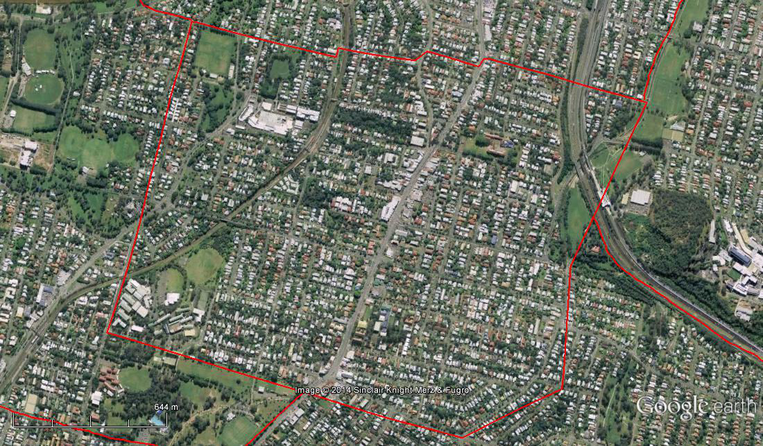
The Spatial Description of the Fairfield-Annerley Local Area Study
1 mile = 1.609 km
Accumulative Path:
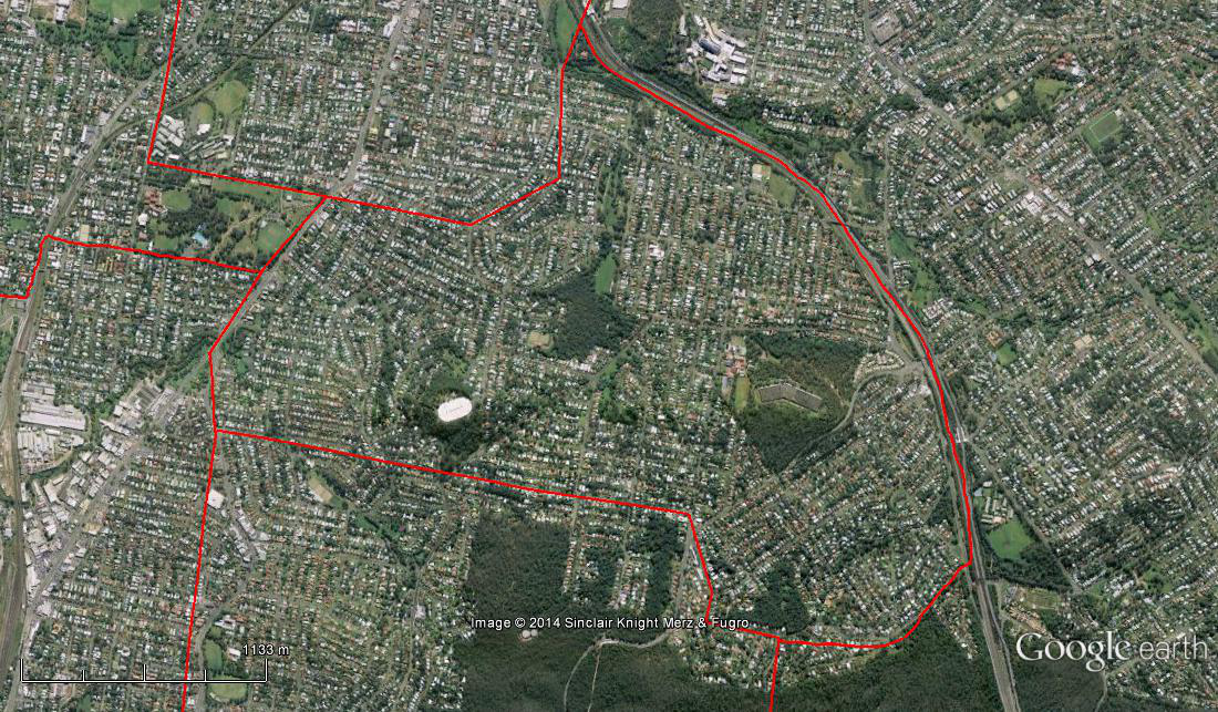
1.08 miles (1.73 km) on Northern West-East boundary, Home & Victoria Street Intersection to, via Denham Street & Louis Street, Victoria Terrace, line across to Norman Creek
2.13 miles (3.44 km) on Eastern North-South boundary, Norman Creek (line across from Victoria Terrace) to, via Arnwood Place & Gilmore & Downes Street Intersection, Ekibin & Cracknell Road Intersection
3.07 miles (4.95 km) on Southern East-West boundary, Ekibin & Cracknell Road Intersection to Villa Street & Park Road Intersection
3.90 miles (6.27 km) on Western South-North boundary, Villa Street & Park Road Intersection to Crutchley & Victoria Street Intersection
4.09 miles (6.58 km) on Northern connection line, Crutchley & Victoria Street Intersection to Home & Victoria Street Intersection
The Spatial Description of the Ekibin-Tarragindi Local Area Study
1 mile = 1.609 km
Accumulative Path:
For Southern East –West boundary, adjoin with Northern West-East boundary of the Moorooka-Tarragindi Study Area for the 1.35 miles (2.18 km), Beaudesert Road & Vendale Avenue Intersection to Prior Street & Toohey Road Intersection.
For Western North-South boundary, adjoin with part of Eastern North-South boundary of the Moorooka- Tarragindi Study Area for the 0.51 miles (0.82 km) Prior Street & Toohey Road Intersection to, via Monash Road & Ferrand & Barnehurst Street Intersection, and then continuation of Monash Road to the South East Freeway and the mountain source of the Norman Creek (southern tributary).
2.65 miles (4.27 km) on Eastern South-North boundary from the mountain source of the Norman Creek (southern tributary), along South East Freeway and Norman Creek system to Arnwood Place.
For second Western North-South boundary, adjoin with part of Eastern North-South boundary of the Fairfield- Annerley Study Area for the 0.70 miles (1.12 km), Arnwood Place & Gilmore & Downes Street Intersection, Ekibin & Cracknell Road Intersection.
For Northern East-West boundary, adjoin with part of Southern East-West boundary of the Fairfield- Annerley Study Area for the 0.41 miles (0.66 km) on boundary, Ekibin & Cracknell Road Intersection to Villa Street & Ipswich Road Intersection.
0.77 miles (1.24 km) on third Western North- South boundary, Ipswich Road to intersection with Beaudesert Road, to Beaudesert Road & Vendale Avenue Intersection.
The Spatial Description of the Rocklea-Yeerongpilly-Moorooka Local Area Study
1 mile = 1.609 km
Accumulative Path:
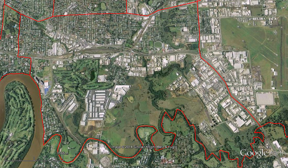
For Northern West-East boundary, adjoin with Southern West- East boundary of the Yeronga Study Area for the 1.04 miles (1.68 km), King Arthur Terrace to Fairfield Road, line from Fairfield to and along School Road to Ipswich Road intersection.
For Western North-South boundary, adjoin with several: third Western North- South boundary of Ekibin-Tarragindi Study Area for the 0.77 miles (1.24 km) Ipswich Road to intersection with Beaudesert Road, to Beaudesert Road & Vendale Avenue Intersection; Western North -South boundary of the Moorooka-Tarragindi Study Area for the 5.23 miles (8.42 km) on Beaudesert Road a Vendale Avenue Intersection to Beaudesert & Evans Road Intersection; Western North-South boundary of the Salisbury-Nathan Study Area for the 1.05 miles (1.69 km), Beaudesert & Evans Road Intersection to Beaudesert & Riawena Road Intersection.
For Southern East-West boundary, adjoin both the third Northern East- West boundary of the Archerfield-Acacia Ridge Study Area for the 0.85 miles (1.37 km), Beaudesert & Riawena Road Intersection to Granard Road exit/entry to the Ipswich Motorway; and the second Northern East- West boundary of the Archerfield-Acacia Ridge Study Area for the 1.20 miles (1.93 km), Granard Road exit/entry to the Ipswich Motorway to Oxley Creek crossing at Ipswich Motorway.
6.31 miles (10.16 km) on the Eastern South-North boundary, Oxley Creek crossing at Ipswich Motorway, Oxley Creek downstream to the Brisbane River.
1.00 mile (1.61 km) on the second Northern West-East boundary, mouth of the Oxley Creek on the Brisbane River, along south bank of Brisbane River to point on King Arthur Terrace to mark the Yeronga Study Area.
The Spatial Description of the Moorooka-Tarragindi Local Area Study
1 mile = 1.609 km
Accumulative Path:
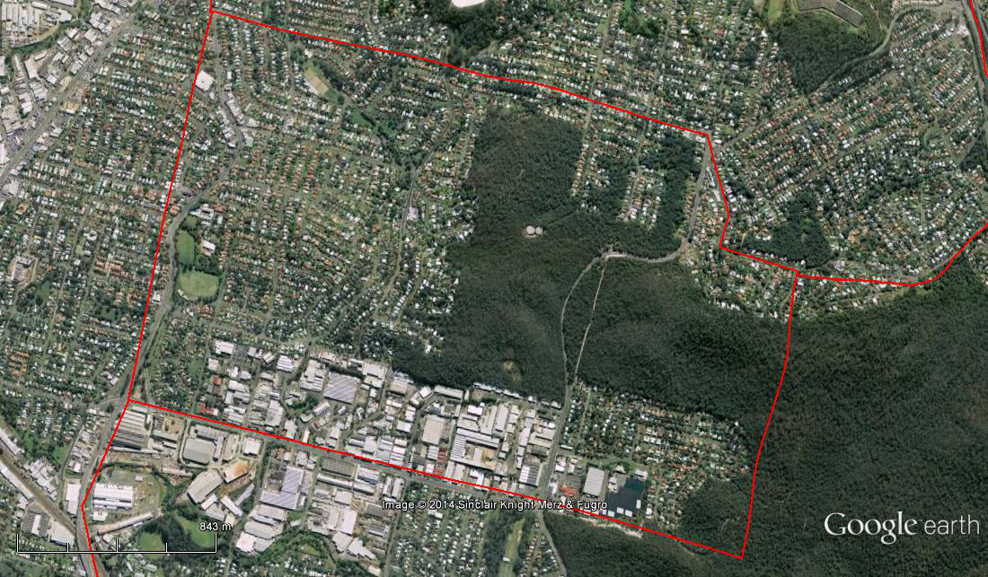
1.35 miles (2.18 km) on Northern West-East boundary, Beaudesert Road & Vendale Avenue Intersection to Prior Street & Toohey Road Intersection
2.58 miles (4.16 km) on Eastern North-South boundary, Prior Street & Toohey Road Intersection to, via Monash Road & Ferrand & Barnehurst Street Intersection, a point in Toohey Forest in line with Evans Road ( 27O 32’ 49.34 S; 153O 02’ 48.64 E)
4.20 miles (6.76 km) on Southern East-West boundary, Toohey Forest in line with Evans Road (27O 32’ 49.34 S; 153O 02’ 48.64 E ) to Beaudesert & Evans Road Intersection
5.23 miles (8.42 km) on Western South-North boundary, Beaudesert & Evans Road Intersection to , Beaudesert Road & Vendale Avenue Intersection
The Spatial Description of the Salisbury-Nathan Local Area Study
1 mile = 1.609 km
Accumulative Path:
For Western North-South boundary, adjoin with part of Eastern North-South boundary of the Moorooka- Tarragindi Study Area for the 0.71 miles (1.14 km), Ferrand & Barnehurst Street Intersection, a point in Toohey Forest in line with Evans Road ( 27O 32’ 49.34 S; 153O 02’ 48.64 E).
For Northern West – East boundary, adjoin with part of Southern West – East boundary boundary of the Moorooka- Tarragindi Study Area for the 4.20 miles (6.76 km), Toohey Forest in line with Evans Road (27O 32’ 49.34 S; 153O 02’ 48.64 E ) to Beaudesert & Evans Road Intersection.
1.05 miles (1.69 km) on Western North-South boundary, Beaudesert & Evans Road Intersection to Beaudesert & Riawena Road Intersection.
2.81 miles (4.52 km) on Southern East –West boundary, Beaudesert & Riawena Road Intersection to Kessels and Mains Road Intersection.
2.02 miles (3.25 km) on Western South- North boundary, Kessels and Mains Road Intersection to South-East Freeway to line with Monash Road.
0.59 miles (0.95 km) on Northern East- West boundary, Monash Road to Ferrand & Barnehurst Street Intersection.
south bank of Brisbane River to point on King Arthur Terrace to mark the Yeronga Study Area.

The Spatial Description of the Archerfield-Acacia Ridge Local Area Study
1 mile = 1.609 km
Accumulative Path:
For North-East corner, adjoin with Western North -South boundary of the Coopers Plains-Robertson Study Area for the 0.70 miles (1.12 km), Beaudesert & Riawena Road Intersection to Beaudesert & Boundary Road Intersection.
For Northern West-East boundary, adjoin with Southern West- East boundary of the Coopers Plains-Robertson Study Area for 0.88 miles (1.41 km) Beaudesert & Boundary Road Intersection to Orange Grove & Boundary Road Intersection.
For Western North-South boundary, adjoin with both the small corner of the Banoon-Sunnybank Study Area for 0.10 miles (0.16 km) ,Orange Grove & Boundary Road Intersection to Bovey Street & Beenleigh Road Intersection; and the Sunnybank Hills Study Area, being 0.31 miles (0.50 km) on its North-West corner, Bovey Street & Beenleigh Road Intersection to Bradman Street and Beenleigh Road Intersection, and 1.76 miles (2.83 km) on its Western North-South boundary, Bradman Street and Beenleigh Road Intersection to intersection with Landeer Street, and then intersection with Ingram Road to Hellawell and Beaudesert Road Intersection.
For Southern West-East boundary, adjoin with second Northern West – East boundary of the Algester-Calamvale-Parkinson Study Area for the 0.73 miles (1.17 km) Hellawell and Beaudesert Road Intersection to Kev Hooper Bridge on Learoyd Road, and then the 0.83 miles (1.34 km) Learoyd Road to the Oxley Creek crossing.
3.18 miles (5.12 km)on Eastern South-North boundary, Oxley Creek downstream to crossing at Ipswich Motorway.
1.20 miles (1.93 km) on second Northern West-East boundary, Oxley Creek crossing at Ipswich Motorway to Granard Road exit/entry to the Ipswich Motorway.
0.85 miles (1.37 km) on third Northern West-East boundary, Granard Road exit/entry to the Ipswich Motorway to Beaudesert & Riawena Road Intersection.
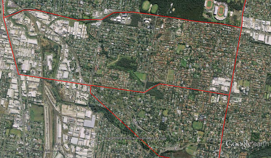
The Spatial Description of the Coopers Plains-Robertson Local Area Study
1 mile = 1.609 km
Accumulative Path:
For Northern West-East boundary, adjoin with Southern West-East boundary of the Salisbury-Nathan Study Area for the 2.02 miles (3.25 km), Beaudesert & Riawena Road Intersection to Kessels and Mains Road Intersection.
0.78 miles (1.25 km) on Western North-South boundary, Kessels and Mains Road Intersection to Mains Road and McCulloch Street Intersection.
For Southern East-West boundary, adjoin with on Northern East-West boundary of the Banoon-Sunnybank Study Area for 1.62 miles (2.61 km), McCullough & Mains Road Intersection to Orange Grove & Boundary Road Intersection, and then for 0.88 miles (1.41 km) Orange Grove & Boundary Road Intersection to Beaudesert & Boundary Road Intersection.
0.70 miles (1.12 km) on Western South-North boundary, to Beaudesert & Boundary Road Intersection to Beaudesert & Riawena Road Intersection.
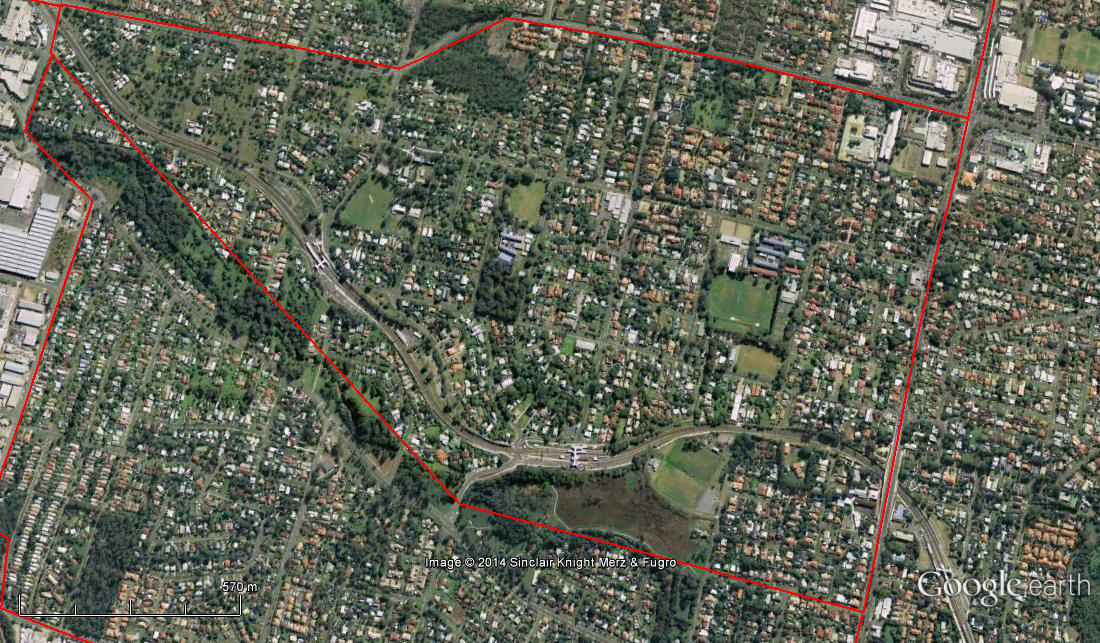
The Spatial Description of the Banoon-Sunnybank Local Area Study
1 mile = 1.609 km
Accumulative Path:
1.62 miles (2.61 km) on Northern West-East boundary, Orange Grove & Boundary Road Intersection to McCullough & Mains Road Intersection
2.45 miles (3.94 km) on Eastern North-South boundary, McCullough Street & Mains Road Intersection to Mains Road & Mulgowie Street Intersection
4.20 miles (6.75 km) on Southern East-West boundary, Mains Road & Mulgowie Street Intersection to, via bend inwards at Stones Road, Bovey Street & Beenleigh Road Intersection
4.28 miles (6.89 km) on Western South-North boundary, Bovey Street & Beenleigh Road Intersection to Orange Grove & Boundary Road Intersection
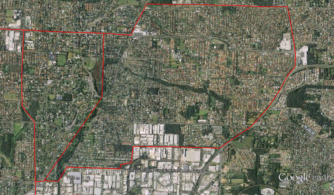
The Spatial Description of the Sunnybank Hills Local Area Study
1 mile = 1.609 km
Accumulative Path:
For Northern East -West boundary, adjoin with on Southern East-West boundary of the Banoon-Sunnybank Study Area for the 4.20 miles (6.75 km), Mains Road & Mulgowie Street Intersection to, via bend inwards at Stones Road, Bovey Street & Beenleigh Road Intersection (roughly marking the Stable Swamp Creek southern branch).
0.31 miles (0.50 km) on North-West corner, Bovey Street & Beenleigh Road Intersection to Bradman Street and Beenleigh Road Intersection.
1.76 miles (2.83 km) on Western North-South boundary, Bradman Street and Beenleigh Road Intersection to intersection with Landeer Street, and then intersection with Ingram Road to Hellawell and Beaudesert Road Intersection.
1.77 miles (2.85 km) on the Southern West-East boundary, Hellawell and Beaudesert Road Intersection to Compton and Beaudesert Road Intersection, to Gowan and Compton Road Intersection.
1.44 miles (2.31 km) on Eastern South-North boundary, Gowan and Compton Road Intersection to Beenleigh and Gowan Road Intersection.
0.66 miles (1.06) on North-East corner, Beenleigh and Gowan Road Intersection to Mains and Beenleigh Road Intersection, and then to Mulgowie Street and Mains Road Intersection
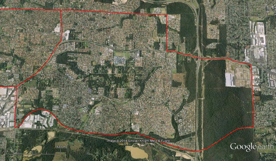
The Spatial Description of the Algester-Calamvale-Parkinson Local Area Study
1 mile = 1.609 km
Accumulative Path:
For Northern East -West boundary, adjoin with Southern East-West boundary of the Sunnybank Hills Study Area for the 1.77 miles (2.85 km), Hellawell and Beaudesert Road Intersection to Compton and Beaudesert Road Intersection, to Gowan and Compton Road Intersection.
2.00 miles (3.22 km) on Western North-South boundary, Gowan and Compton Road Intersection to Illaweena Street and Gowan Road Intersection.
0.74 miles (1.18 km) on Southern East-West boundary, Illaweena Street and Gowan Road Intersection to Beaudesert Road and Illaweena Street Intersection.
1.57 miles (2.52 km) on the second Western North-South boundary, Beaudesert Road and Illaweena Street Intersection to the Johnson Road and Beaudesert Road Intersection.
1.10 miles (1.77 km) on the second Southern East-West boundary, Johnson Road and Beaudesert Road Intersection (Brisbane City boundary) to the Interstate Railway Line.
4.60 miles (7.40 km) on the Eastern South-North boundary, the length of the Interstate Railway Line to Kev Hooper Bridge on Learoyd Road.
0.73 miles (1.17 km) on second Northern East -West boundary, Kev Hooper Bridge on Learoyd Road to Hellawell and Beaudesert Road Intersection.