Stages Of Research

This concept of a collection of local history mapping data is innovative. Each ‘map’ will be a ‘single canvas’, completing a picture of the local area that can only be achieved by combining data from various historical sources. The website delivery of digital files that can be created with different layers of cartographical and historical detail is a creative way to share history with the public.

Add to the descriptions the methodology in the map design and the changing landscape that each map reveals and this becomes a valuable research tool. The website publication of map images will include full citations and statements about the composition. This will alert the general public to various documents held as local collections, including depositaries of aerial photography, cadastral surveys, real estate maps, and landscape images.

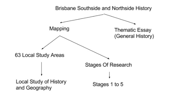
The Mapping Brisbane History Project (MBH) has completed three stages of research and website design since 2012. These three phases of the project was funded by the Brisbane City Council Community History Grants.

Research Stages

Research Stage 1

The MBH Project began in 2012 with a pilot study of three local areas: Coopers Plains (Banoon)-Sunnybank, Moorooka-Tarragindi, and Fairfield-Annerley.
Read More

Research Stage 2

A further stage to the project was added in 2015 with addition to the website of five thematic essays on the Brisbane Southside history. It signalled that the MBH long-term project is more than a mapping exercise. The project is about multiple studies in local history with geographic focus.
Read More

Research Stage 3

In 2017 a final Council funded stage began to complete website and online mapping program. However, the additions of further historical sites into the program, or editing of existing sites, are anticipated. The MBH Project is a site of ongoing local history study. It is not a museum piece.
Read More

Research Stage 4

Stages 4 and 5 are the ongoing, concurrent, local history studies, interpreting the data in the geographical context. Stage 4 is the local studies by any number of professional and scholarly historians with the Brisbane Southside History network of marked sites.
Read More

Research Stage 5

Stages 4 and 5 are the ongoing, concurrent, local history studies, interpreting the data in the geographical context. Stage 5 is the local studies by any number of professional and scholarly historians with the Brisbane Northside History network of marked sites.
Read More
Explore Maps

Project Structure