Indigenous Sites across Brisbane Southside: Ray Kerkhove
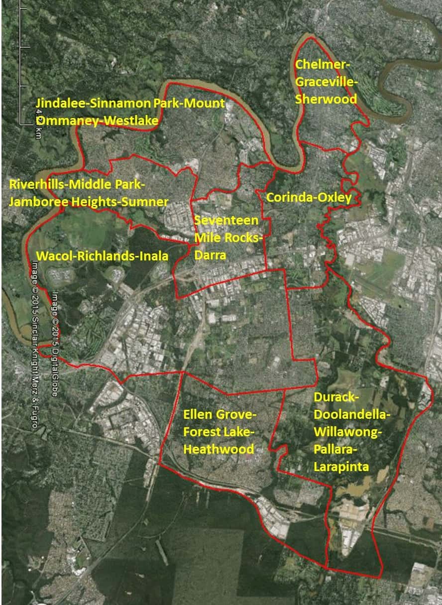
Stage 4.5 Study Areas

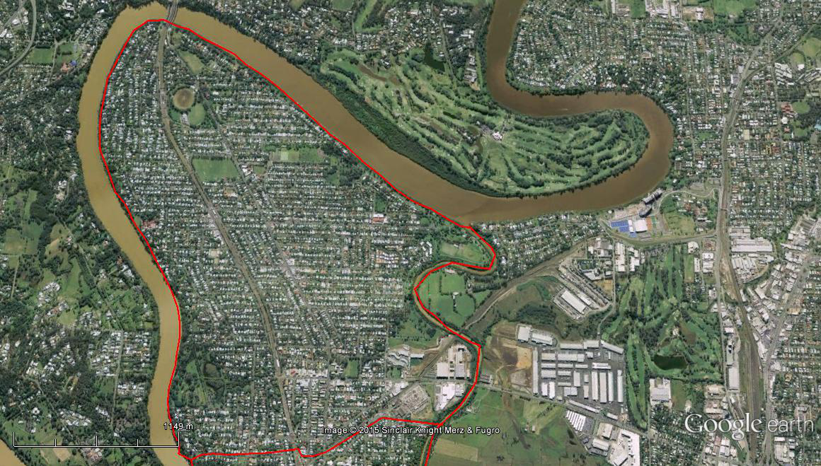
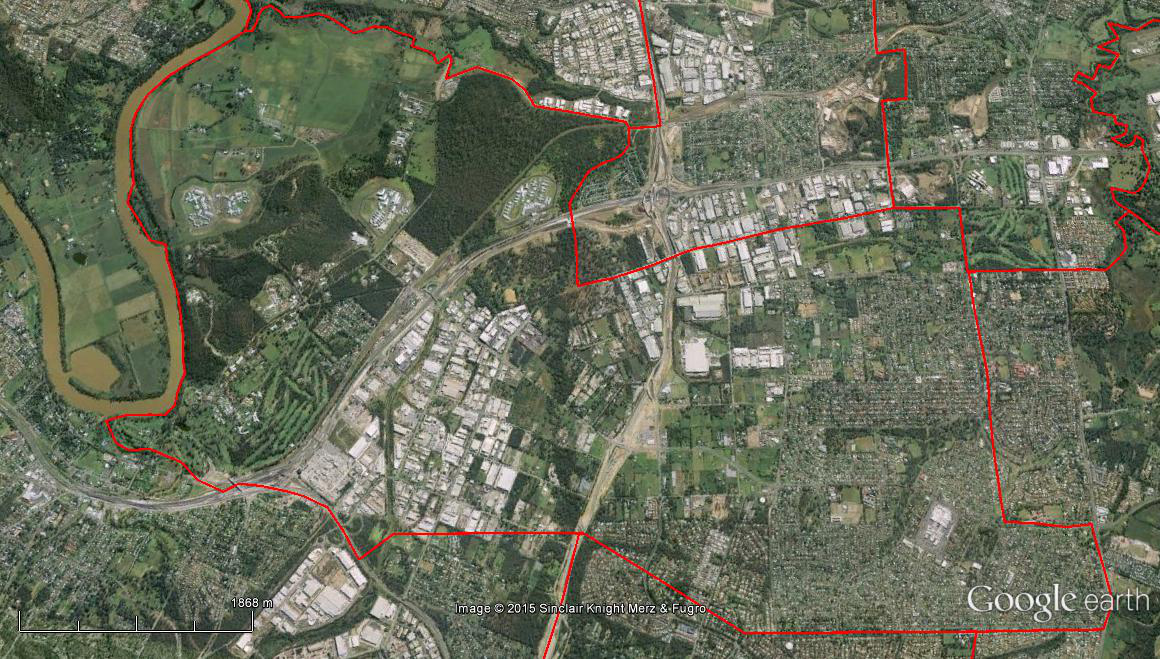
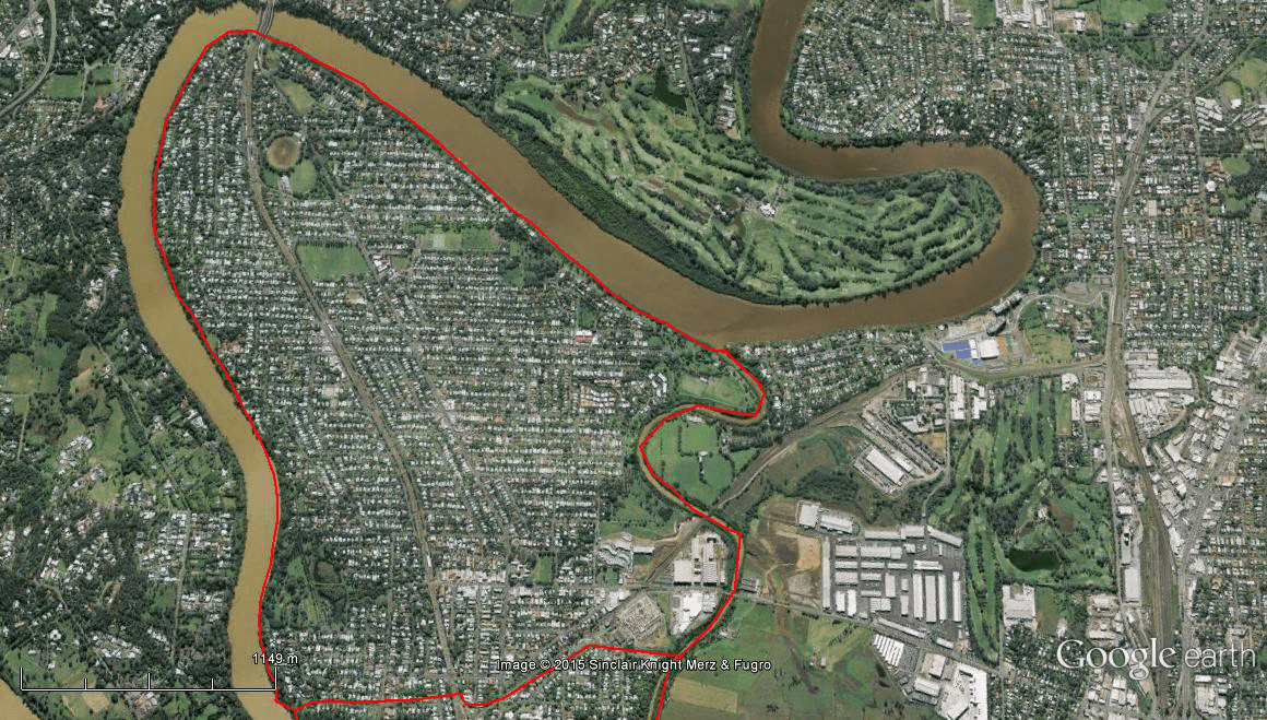
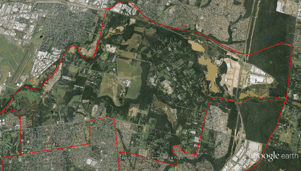
The Spatial Description of the Chelmer-Graceville-Sherwood Local Area Study
1 mile = 1.609 km
Straight Line Between Start-Finish Line:
1.82 miles (2.93 km) on Northern West-East boundary, Walter Taylor Bridge, Brisbane River downstream, to mouth of the Oxley Creek.
0.88 miles (1.41 km) on Eastern North-South boundary, mouth of the Oxley Creek, following Oxley Creek upstream, to a point south (27°32’10.88″S, 152°59’25.75″E) on the Oxley Creek.
1.08 miles (1.74 km) on Southern East-West boundary, a point (27°32’10.88″S, 152°59’25.75″E) on the Oxley Creek, following Railway Terrace, across to Hilda Street to a point west (27°32’10.72″S, 152°58’20.66″E) on the Brisbane River near Devaney Lane.
2.05 miles (3.30 km) on Western South-North boundary, to a point (27°32’10.72″S, 152°58’20.66″E) on the Brisbane River near Devaney Lane, Brisbane River downstream, to Walter Taylor Bridge.
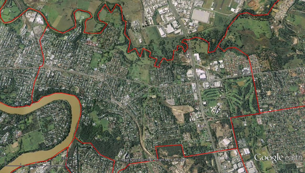
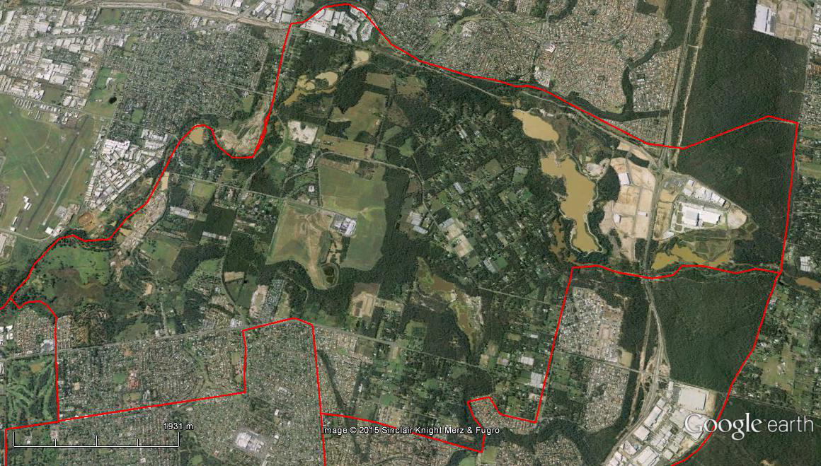
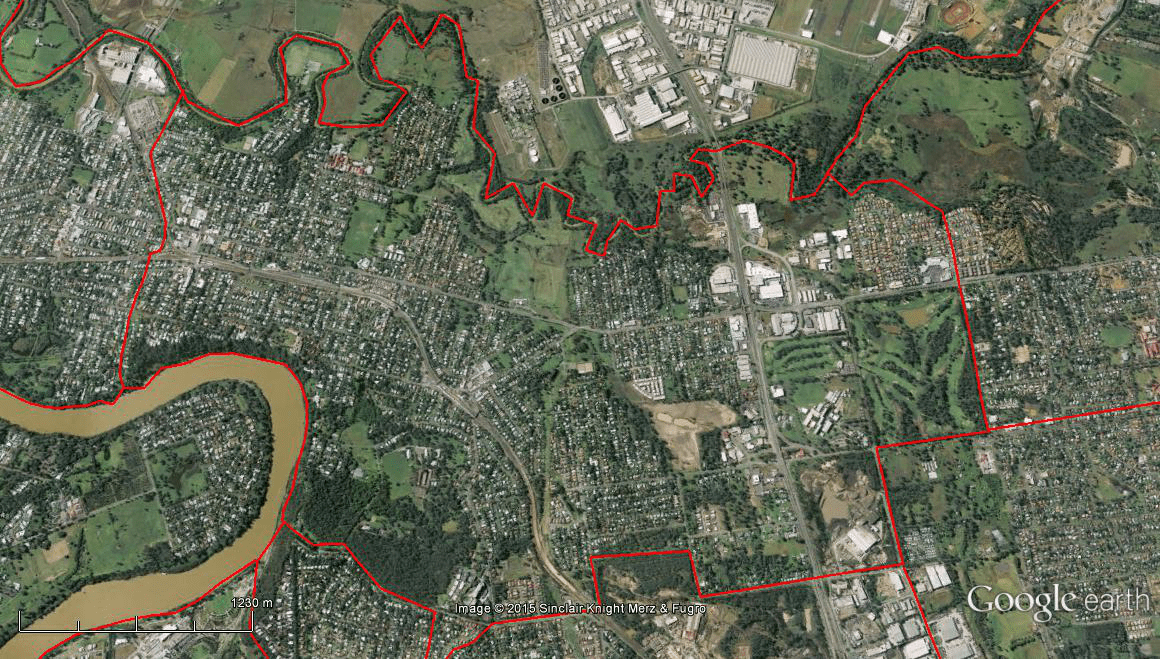
The Spatial Description of the Corinda-Oxley Local Area Study
1 mile = 1.609 km
Straight Line Between Start-Finish Line:
1.08 miles (1.74 km) on Northern West-East boundary, a point (27°32’10.72″S, 152°58’20.66″E) on the Brisbane River near Devaney Lane, across to Hilda Street following Railway Terrace, a point east (27°32’10.88″S, 152°59’25.75″E) on the Oxley Creek.
2.35 miles (3.78 km) on Eastern North-South boundary, a point (27°32’10.88″S, 152°59’25.75″E) on the Oxley Creek, following the Oxley Creek upstream, to a point south (27°34’12.47″S, 152°59’18.72″E) on the Oxley Creek.
1.04 miles (1.67 km) on Southern East-West boundary, a point (27°34’12.47″S, 152°59’18.72″E) on the Oxley Creek, following the west slope of the Oxley Common, an alignment of Oakmont Avenue and Freeman Road, to Freeman Road & Rosemary Street Intersection.
1.98 miles (3.19 km) on Western South-North boundary, Freeman Road & Rosemary Street Intersection, via Rudd Street & Boundary Road Intersection, Kimberley Street & Boundary Road Intersection, Dowding & Valance Streets Intersection, Holmedale & Valance Streets Intersection, Holmedale Street & Englefeld Road Intersection, the meeting point of Englefeld Road, Ipswich railway Line, and Ashridge Road, Pannard Street & Seventeen Miles Rocks Road , Seventeen Miles Rocks suburb boundary following Fort Road, a point (27°32’40.84″S, 152°57’57.93″E) on the Brisbane River, Brisbane River downstream, to a point (27°32’10.72″S, 152°58’20.66″E) on the Brisbane River near Devaney Lane.
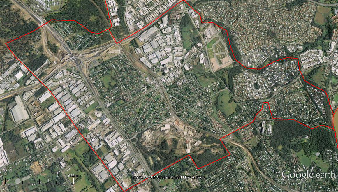
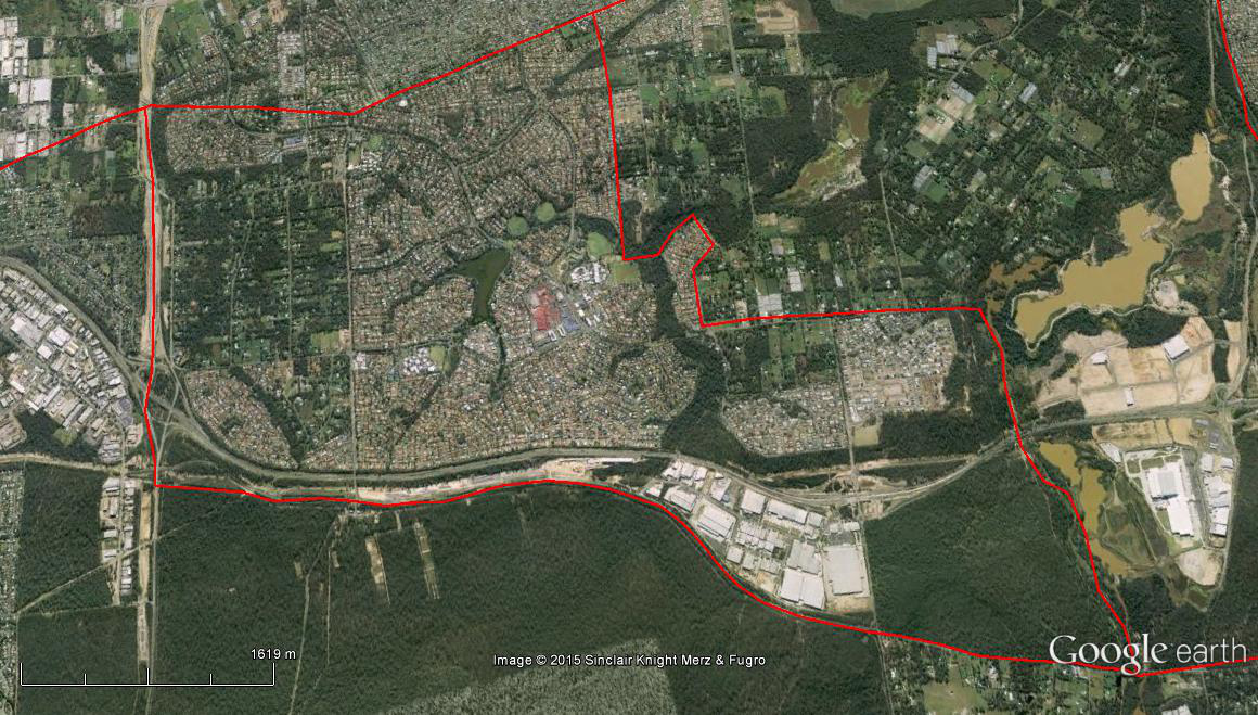
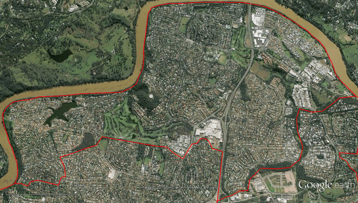
The Spatial Description of the Seventeen Mile Rocks-Darra Local Area Study
1 mile = 1.609 km
Straight Line Between Start-Finish Line:
1.98 miles (3.19 km) on Eastern North-South boundary, a point (27°32’40.84″S, 152°57’57.93″E) on the Brisbane River, following Fort Road, Seventeen Miles Rocks suburb boundary, Pannard Street & Seventeen Miles Rocks Road, the meeting point of Englefeld Road, Ipswich railway Line, and Ashridge Road, Holmedale Street & Englefeld Road Intersection, Holmedale & Valance Streets Intersection, Dowding & Valance Streets Intersection, to Kimberley Street & Boundary Road Intersection.
1.86 miles (2.99 km) on Southern East-West boundary, Kimberley Street & Boundary Road Intersection, following Boundary Road, to a point west (27°35’2.28″S, 152°56’15.36″E) on the Bullockhead Creek.
1.83 miles (2.95 km) on Western South-North boundary, a point (27°35’2.28″S, 152°56’15.36″E) on the Bullockhead Creek, following Bullockhead Creek to Wolston Road, Wolston Road to where Ipswich Railway line goes under Centenary Motorway, to where Monier Road meets the Centenary Motorway.
1.86 miles (2.99 km) on Northern West-East boundary, where Monier Road meets the Centenary Motorway, following parkland/bushland along the Sinnamon Park suburb boundary, to a point (27°32’38.58″S, 152°57’50.82″E) on the Brisbane River, Brisbane River downstream, to a point (27°32’40.84″S, 152°57’57.93″E) on the Brisbane River near Fort Road.
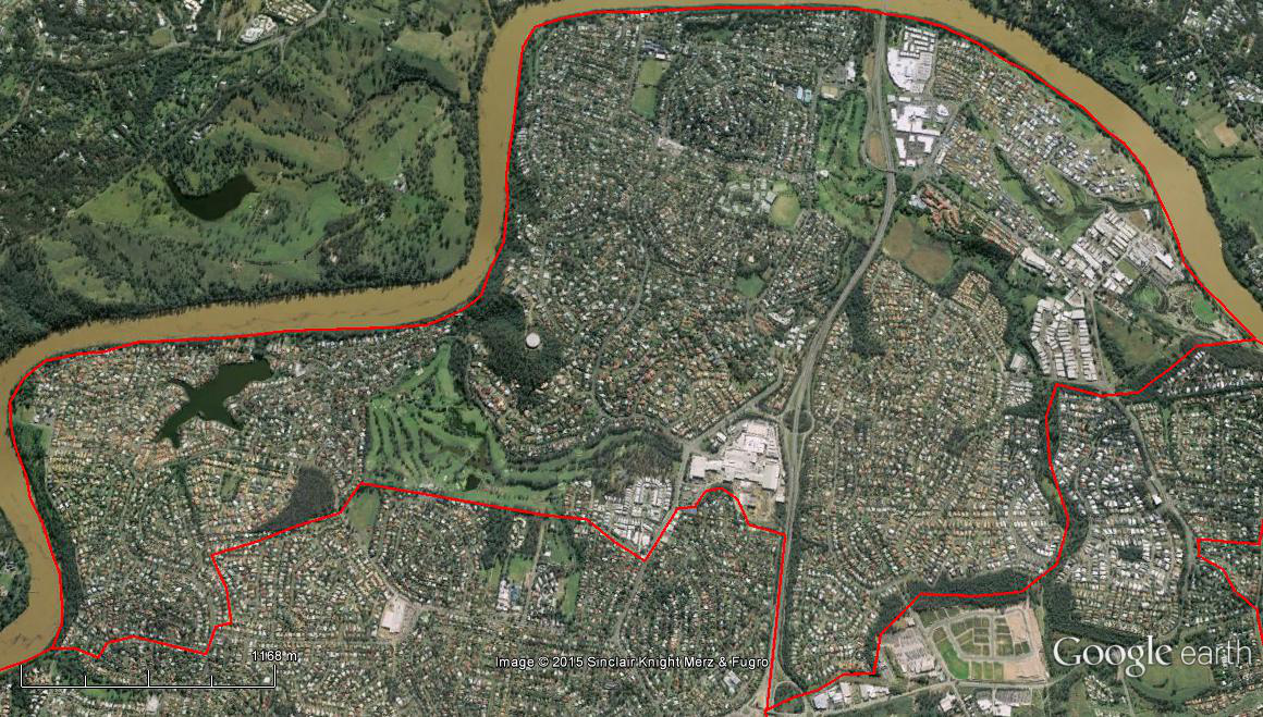
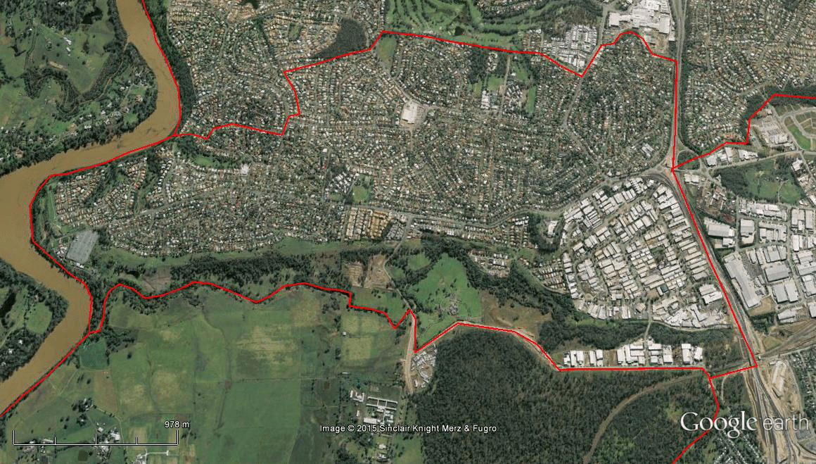
The Spatial Description of the Jindalee- Sinnamon Park- Mount Ommaney-Westlake Local Area Study
1 mile = 1.609 km
Straight Line Between Start-Finish Line:
1.82 miles (2.93 km) on Eastern North-South boundary, a point (27°32’38.58″S, 152°57’50.82″E) on the Brisbane River, following parkland/bushland along the Sinnamon Park suburb boundary, to where Monier Road meets the Centenary Motorway.
2.02 miles (3.25 km) on Southern East-West boundary, where Monier Road meets the Centenary Motorway, a point (27°33’8.23″S, 152°56’27.19″E) on the Centenary Motorway near Galleon Street, southern boundary of Mount Ommaney Shopping Centre, Loffs & Dandenong Roads Intersection, southern boundary of McLeod Golf Club Course, Middle Park suburban boundary, to a point west (27°33’23.81″S, 152°54’23.60″E) on the Brisbane River near Riverview Close.
3.10 miles (4.99 km) on Western South-North boundary, a point (27°33’23.81″S, 152°54’23.60″E) on the Brisbane River near Riverview Close, Brisbane River downstream, to a point (27°32’38.58″S, 152°57’50.82″E) on the Brisbane River.

The Spatial Description of the Riverhills-Middle Park-Jamboree Heights-Sumner Local Area Study
1 mile = 1.609 km
Straight Line Between Start-Finish Line:
2.11 miles (3.40 km) on Northern West-East boundary, a point (27°33’23.81″S, 152°54’23.60″E) on the Brisbane River near Riverview Close, Westlake suburban boundary, southern boundary of McLeod Golf Club Course, Loffs & Dandenong Roads Intersection, southern boundary of Mount Ommaney Shopping Centre, a point east (27°33’8.23″S, 152°56’27.19″E) on the Centenary Motorway near Galleon Street.
1.25 miles (2.02 km) on Eastern North-South boundary, a point (27°33’8.23″S, 152°56’27.19″E) on the Centenary Motorway near Galleon Street, to where Ipswich Railway line goes under Centenary Motorway.
2.56 miles (4.12 km) on Southern East-West boundary, where Ipswich Railway line goes under Centenary Motorway, across to Wolston Road, Wolston & Wacol Station Roads Intersection, where Wacol Station Road crosses Wolston Creek, Wolston Creek downstream, to mouth of Wolston Creek.
0.82 miles (1.32 km) on Western South-North boundary, mouth of Wolston Creek, Brisbane River downstream, a point (27°33’23.81″S, 152°54’23.60″E) on the Brisbane River near Riverview Close.
The Spatial Description of the Wacol-Richlands-Inala Local Area Study
1 mile = 1.609 km
Straight Line Between Start-Finish Line:
2.38 miles (3.83 km) on Northern West-East boundary (Part 1), mouth of Wolston Creek, Wolston Creek upstream, where Wacol Station Road crosses Wolston Creek, Wolston & Wacol Station Roads Intersection, following Wolston Road, to where Bullockhead Creek meets Wolston Road,
1.03 miles (1.65 km) on Eastern North-South boundary (Part 1), where Bullockhead Creek meets Wolston Road, following Bullockhead Creek upstream, to a point south (27°35’2.28″S, 152°56’15.36″E) on the Bullockhead Creek.
2.22 miles (3.57 km) on Northern West-East boundary (Part 2), a point (27°35’2.28″S, 152°56’15.36″E) on the Bullockhead Creek, following Boundary Road, to Rudd Street & Boundary Road Intersection.
2.34 miles (3.77 km) on Eastern North-South boundary (Part 2), Rudd Street & Boundary Road Intersection, an alignment of Rudd and Rosemary Streets across to Inala Avenue, Inala Avenue & Blunder Road Intersection, to Lorkeet Street & Blunder Road Intersection.
5.33 miles (8.58 km) on Southern East-West boundary, Lorkeet Street & Blunder Road Intersection, an alignment of Lorkeet Street and Boss Road, Forest Lake suburban boundary, a point (27°36’17.31″S, 152°56’38.30″E) of the Centenary Motorway near Lilydale Place, Carole Park, Gailes & Goodna suburban boundaries, to the mouth of Woogaroo Creek.
2.44 miles (3.93 km) on Western South-North boundary, mouth of Woogaroo Creek, Brisbane River downstream, to the mouth of Wolston Creek.
The Spatial Description of the Durack- Doolandella-Willawong-Pallara-Larapinta Local Area Study
1 mile = 1.609 km
Straight Line Between Start-Finish Line:
1.04 miles (1.67km) on Northern West-East boundary, Freeman Road & Rosemary Street Intersection, an alignment of Oakmont Avenue and Freeman Road, following the west slope of the Oxley Common, a point east (27°34’12.47″S, 152°59’18.72″E) on the Oxley Creek.
6.30 miles (10.14 km) on Eastern North-South boundary, a point (27°34’12.47″S, 152°59’18.72″E) on the Oxley Creek, following the Oxley Creek upstream, Learoyd & Watson Roads Intersection (near King Avenue Bridge), to where Learoyd Road crosses the Interstate Railway Line, following the Interstate Railway Line, to where Johnston Road crosses the Interstate Railway Line.
1.23 miles (1.99 km) on Southern East-West boundary, where Johnson Road crosses the Interstate Railway Line, following Johnson Road, to where Johnson Road crosses the Oxley Creek.
5.53 miles (8.90 km) on Western South-North boundary, where Johnson Road crosses the Oxley Creek, via a point (27°37’56.87″S, 152°59’54.96″E) on the Oxley Creek near Wadeville Street, an alignment of Wadeville Street and Forest Lake Boulevard, Forest Lake Boulevard & Old Blunder Road Intersection, Forest Lake suburban boundary, Lorkeet Street & Warrigal Court Intersection, Lorkeet Street & Blunder Road Intersection, Inala Avenue & Blunder Road Intersection, an alignment of Rosemary Street, to Freeman Road & Rosemary Street Intersection.
The Spatial Description of the Ellen Grove-Forest Lake- Heathwood Local Area Study
1 mile = 1.609 km
Straight Line Between Start-Finish Line:
2.08 miles (3.35 km) on Northern West-East boundary, a point (27°36’17.31″S, 152°56’38.30″E) of the Centenary Motorway near Lilydale Place, Richlands & Inala suburban boundaries, an alignment of Lorkeet Street and Boss Road, Lorkeet Street & Warrigal Court Intersection.
3.63 miles (5.84 km) on Eastern North-South boundary, Lorkeet Street & Warrigal Court Intersection, Doolandella suburban boundary, Forest Lake Boulevard & Old Blunder Road Intersection, an alignment of Wadeville Street and Forest Lake Boulevard, a point (27°37’56.87″S, 152°59’54.96″E) on the Oxley Creek near Wadeville Street, Oxley Creek upstream, to where Johnson Road crosses the Oxley Creek.
4.02 miles (6.47 km) on Southern East-West boundary, where Johnson Road crosses the Oxley Creek, to where Johnson Road meets Centenary Motorway.
1.70 miles (2.74 km) on Western South-North boundary, where Johnson Road meets Centenary Motorway, to a point north (27°36’17.31″S, 152°56’38.30″E) of the Centenary Motorway near Lilydale Place.