Indigenous Sites across Brisbane Northside: Ray Kerkhove
Stage 5.10 Study Areas
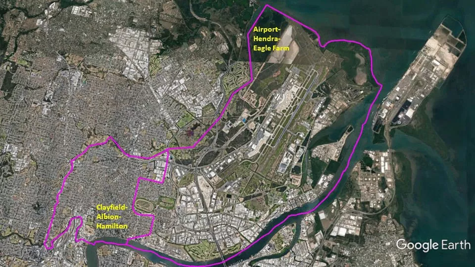
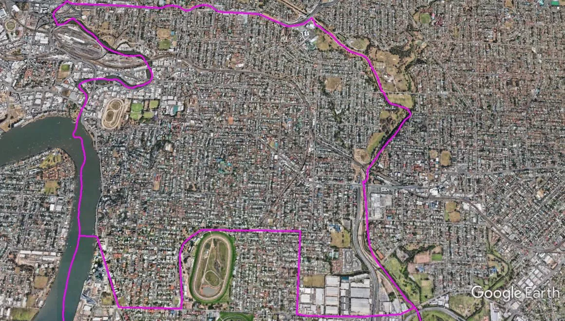
The Spatial Description of the Clayfield-Albion-Hamilton Local Area Study
1 mile = 1.609 km
12.3 miles (19.8 km) encirclement of MBNH LSA 15
2.86miles (4.60 km) on Northern West-East boundary, Gympie-Lutwyche Road Bridge over Kedron Brook, Kedron Book upstream to Nudgee Road bridge.
3.92 miles (6.31 km) on Eastern North-South boundary, Nudgee Road bridge over Kedron Brook, follow Nudgee Road southward to the T-Junction Intersection with Gerler Road, follow Gerler Road to the T-Junction Intersection with Zillmere Road southward, becomes Kitchener Road at railway line, follow railway outbound (around the perimeter of Early Farm Racecourse) to the Nudgee Road railway crossing, Nudgee Road southward (again) to the 4-Way Intersection with Kingsford Smith Drive, follow Kingsford Smith Drive until it meets the Brisbane River at a point (Lat. 27°26’23.05″S, Lon. 153° 3’44.69″E).
3.32 miles (5.35 km) on Southern East-West boundary, the Brisbane River at a point (Lat. 27°26’23.05″S, Lon. 153° 3’44.69″E), follow Brisbane River upstream to the mouth of Breakfast Creek, follow Breakfast Creek upstream to the Lutwyche Road crossing of Breakfast Creek.
2.20 miles (3.54 km) on Western South-North boundary, Lutwyche Road crossing of Breakfast Creek, Lutwyche Road northward to Gympie-Lutwyche Road Bridge over Kedron Brook.
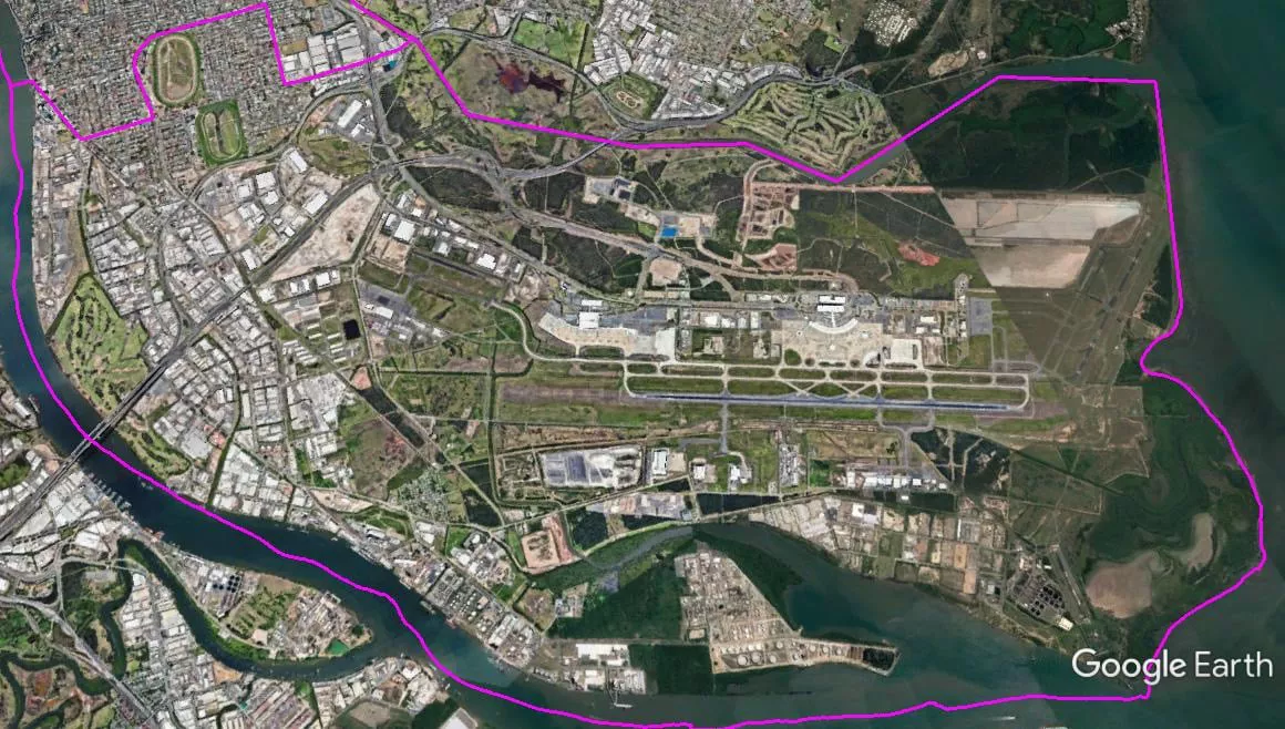
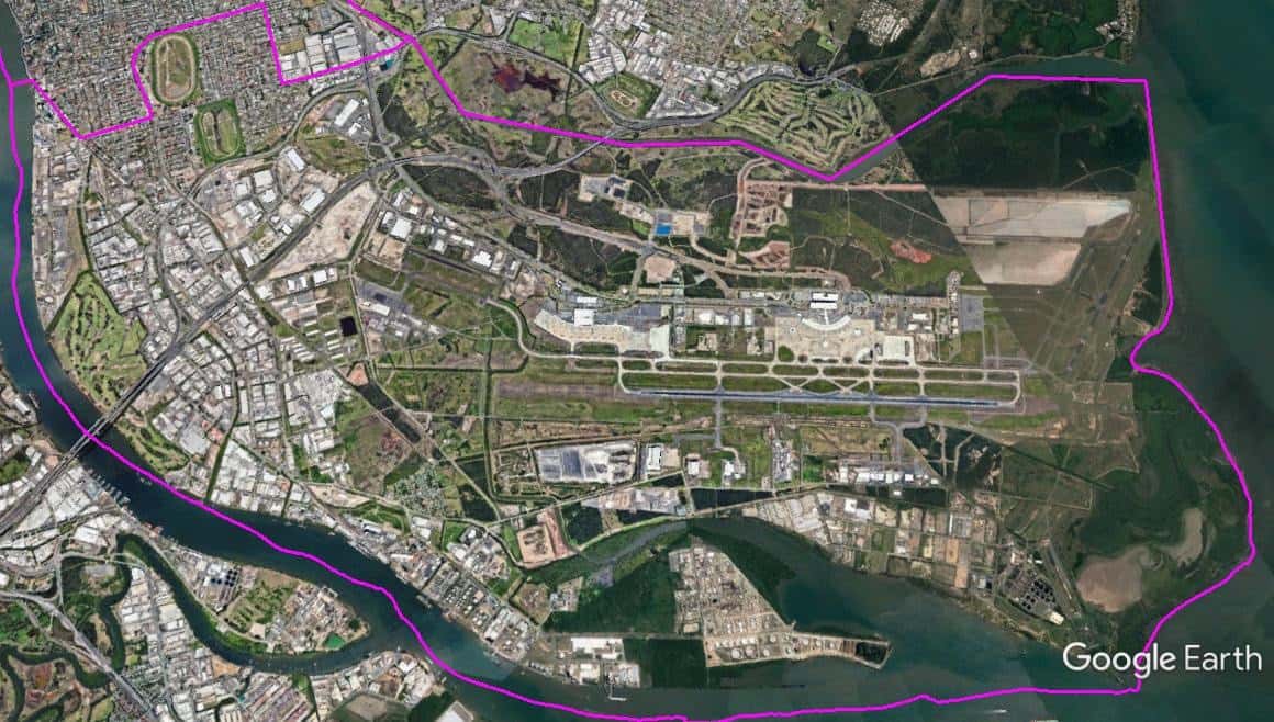
The Spatial Description of the Airport-Hendra-Eagle Farm Local Area Study
1 mile = 1.609 km
22.02 miles (35.46 km) encirclement of MBNH LSA 16
5.13 miles (8.26 km) on Northern West-East boundary, Nudgee Road bridge above Kedron Brook to the mouth of Kedron Book/Schultz Canal in Moreton Bay.
4.35 miles (7.01 km) on Eastern North-South boundary, to the mouth of Kedron Book/Schultz Canal in Moreton Bay, the foreshore of Moreton Bay southward to the mouth of the Brisbane River.
8.62 miles (13.88 km) on Southern East-West boundary, the mouth of the Brisbane River, Brisbane River downstream to a point (Lat. 27°26’23.05″S, Lon. 153° 3’44.69″E) where Kingsford Smith Drive meets the Brisbane River.
3.92 miles (6.31 km) on Western South-North boundary, at a point (Lat. 27°26’23.05″S, Lon. 153° 3’44.69″E) follow Kingsford Smith Drive westward to the 4-Way Intersection with Nudgee Road, Nudgee Road northward to the Nudgee Road railway crossing follow railway inbound (around the perimeter of Early Farm Racecourse) until reaches Kitchener Road, becomes Zillmere Road, follow Zillmere Road northward until he T-Junction Intersection with Gerler Road, follow Gerler Road to Nudgee Road, follow Nudgee Road northward (again) to Nudgee Road bridge over Kedron Brook.