Stage Number: MBSH.02.05.20
Group: Southern
Local Study Area: Moorooka-Tarragindi
Epoch: Early 20th Century
Street Address: Vicinity of 89 Mayfield Road, Moorooka
Latitude & Longitude: -27.53377778,153.02977778
Time Link: 1943
Map Link: 1946
Image Time Point: 1946
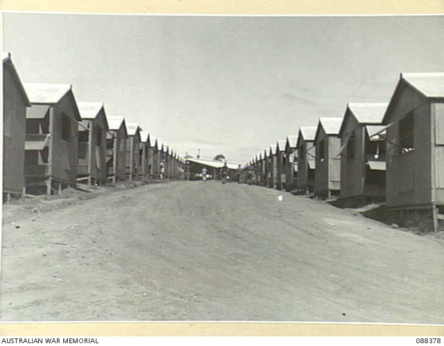
The United States Army Service of Supply (USASOS) set up a large staging camp here, near the Moorooka tram terminus. The area it covered now contains many streets and houses, and back then it also incorporated the Moorooka State School (for three months) and several private residences. There were many tents set up in in lines for the personnel, surrounded by messes, headquarters offices and ablutions in pre-fabricated buildings. There was also a recreation hall where the troops were entertained. At the centre of this complex was a big parade ground. A beneficiary of the presence of Camp Moorooka was the nearby Grey’s Café, which remained open 24 hours a day to serve the constant flow of customers from the camp.
Queensland Government, Queensland World War II Historic Places, ‘Camp Moorooka’ (www.ww2places.qld.gov.au/places/?id=954), sighted 26 July 2017).
A street within the leave and transit depot Queensland lines of communication area, with the other ranks’ mess in the background, Moorooka, April 1945. Australian War Memorial. Record number. 088378.
Qimagery. Brisbane City Council Series 1946. Scale: 1:15,900.