Stage Number: MBSH.02.08.03
Group: Southern
Local Study Area: Coopers Plains-Robertson
Epoch: Early 19th Century
Street Address: Crossing point of Musgrave Road over Stable Swamp Creek, Acacia Ridge
Latitude & Longitude: -27.56177778,153.02897222
Time Link: 1826
Map Link: 1839
Image Time Point: 1839
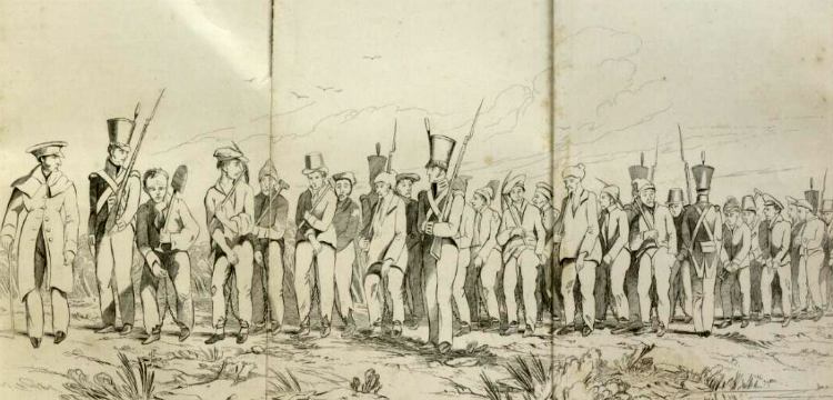
A small convict outpost was built here in 1826 for road gangs working on the development of the main track from Brisbane to Limestone (Ipswich). During the 1830s, a convict-staffed cattle station was established in this area (then known as Cowper’s Plains), supplying meat for the Moreton Bay Penal Settlement.
Beryl Roberts, ‘Naming Brisbane’, Brisbane, B. Roberts, 2013, p.7.
A chain gang, convicts going to work near Sydney, New South Wales, by Edward Backhouse, Edward, 1843. National Library of Australia. nla.obj-138467409.
Granville Stapylton. Survey of Limestone to Brisbane Road. 1839. Lands Museum