Stage Number: MBSH.02.02.44
Group: Southern
Local Study Area: Fairfield-Annerley
Epoch: Early 19th Century
Street Address: Brisbane Corso, Fairfield
Latitude & Longitude: -27.50116667,153.02297222
Time Link: 1823
Map Link: TBA
Image Time Point: TBA
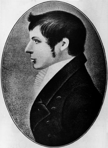
The first recorded non-Indigenous people to step foot in the area were John Finnegan, Thomas Pamphlett and Richard Parsons, three castaway ticket-of-leave men who travelled along the south bank of the Brisbane River on foot in mid-1823, getting as far as Canoe (later Oxley) Creek. They returned by boat in December of that year with surveyor John Oxley, who was examining the suitability of Port Curtis, Moreton Bay, and Port Bowen as sites for convict settlements. His party stepped ashore on the riverbank somewhere between Fenton and Princess Streets and described it as the ‘termination of forest land, and the commencement of brush… with cypresses’.
JG Steele, The Explorers of Moreton Bay 1770-1830, St. Lucia, UQP, 1972, pp.90-91,108-112.
Portrait of surveyor John Oxley. John Oxley Library, State Library of Queensland. Record number. 41931.
Currently Searching