Stage Number: MBSH.03.01.03
Group: Southern
Local Study Area: West End-South Brisbane-North Woolloongabba
Epoch: Late 19th Century
Street Address: Corner of Glenelg and Merivale Streets, South Brisbane
Latitude & Longitude: -27.47866111,153.01941667
Time Link: 1865
Map Link: 1865
Image Time Point: 1865
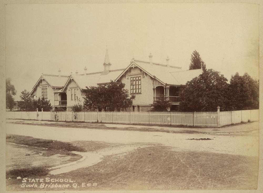
The South Brisbane Primary School opened in January 1865. Prior to the erection of this school, local children had been taught in makeshift conditions at the Mechanic’s Institute on Stanley Street since April 1863. The local population boomed over the following decades and in 1888 the decision was made to divide the now-overcrowded school between two separate buildings. A large new timber building was erected on the other side of Merivale Street, at the corner of Glenelg Street, and this became the Brisbane South Boys School. The original primary school was closed and then re-opened as Brisbane South Girls & Infants School. In 1954, the timber building from 1888 was deteriorating and so the children were transferred to the former Brisbane South Intermediate School buildings. By that time, student numbers were in decline and the Brisbane South Primary School was finally closed on 31 December 1963. Parts of the Girls’ School were later used by Brisbane State High, but the 1888 structure was demolished and its former site is now parkland.
Brisbane Courier, 24 January 1865; Queensland Heritage Council. Queensland Heritage Register. ‘Brisbane State High School, Block H’.
State School at South Brisbane, circa 1906. John Oxley Library. State Library of Queensland. Record number: 236323.
QSA. QSA Series ID 2043 City of Brisbane and Suburbs Maps – A1A Series. 1 chain to the inch. Plan of subdivision of section 30 City of Brisbane. 1 chain to an inch. Surveyor General’s Office, Brisbane.(quarter-size). 634488